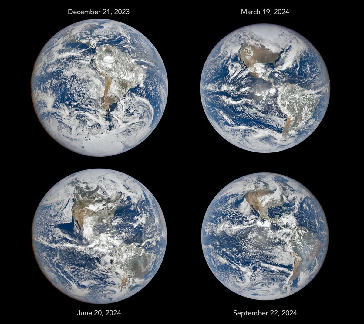
NASA's Earth Polychromatic Image Camera (EPIC), aboard the DSCOVR spacecraft positioned about 1.6 million kilometers from Earth, has captured images showing the seasonal changes visible from deep space, the agency said.
The camera maintains an orbit at Lagrange point 1, a spot between the Sun and Earth where their combined gravitational pull allows the spacecraft to stay in a relatively fixed position. From there, it photographs Earth's sunlit hemisphere every few hours, according to NASA.
Four images taken at the same time of day in December, March, June, and September show how the planet's appearance shifts across the year. In December, South America is near the center of the disk and much of Antarctica is visible, while North America is partially out of view. By June, the situation reverses: the Northern Hemisphere and North America are more centered, Arctic sea ice comes into view, South America is offset, and Antarctica is completely out of view, NASA said.
The change reflects Earth's 23.5-degree axial tilt. Around the June solstice, the Northern Hemisphere leans toward the Sun, bringing more direct sunlight and longer days. Around the December solstice, the Southern Hemisphere does the same. The March and September equinoxes mark the midpoints between these extremes, when the two hemispheres receive nearly equal amounts of sunlight.
The images also show apparent changes in Earth's size in the photographs, caused by variations in the spacecraft's distance from Earth. On December 21, 2023, DSCOVR was 1,447,327 kilometers from Earth, compared with 1,561,901 kilometers on September 22, 2024. This distance difference results from DSCOVR's looping orbit pattern, required to maintain its position at Lagrange point 1.
"You can see the subtle influence of the changing orbital geometry in these images," said Alexander Marshak, the deputy project scientist for the DSCOVR mission. "But the most obvious changes—the apparent location of the continents—are due to Earth's tilt."
EPIC has collected more than a decade of seasonal and daily data on vegetation, clouds, ice, snow, UV radiation, ocean color, and aerosols, according to NASA.